Finding the Darkest Skies in Taranaki & New Zealand
Does New Zealand really have the darkest skies on Earth?
Where might the darkest locations be — and what SQM measurements show so far.
What is the darkest place?
Dark Sky Reserve status does not mean a location has been ranked the darkest place on Earth. Designations such as the Aoraki Mackenzie International Dark Sky Reserve recognise exceptional night skies, along with efforts to protect and manage them.
Extremely dark skies can be found in many remote locations throughout New Zealand and overseas. Rather than relying on claims about which location is darkest, this project focuses on actual measurements taken under real conditions.
Taranaki — One of the World's Best Astrophotography Locations
In my opinion, Taranaki is one of the world's best locations for astrophotography. It's not just the exceptionally dark skies found in many of our rural areas, but the remarkable combination of dramatic landscapes, rugged coastlines, lakes, forests and the magnificent presence of Te Maunga Taranaki.
Some of the region's darkest skies can be found in and around Te Papa-Kura-o-Taranaki (Egmont National Park) and the remote inland areas of eastern Taranaki. These locations offer outstanding opportunities for both stargazing and astrophotography.
I believe Taranaki's night skies deserve to be recognised, protected and celebrated. They are a remarkable natural asset, yet one that can easily be taken for granted. As artificial lighting continues to spread, protecting our remaining dark skies is increasingly important — not just for astrophotographers and astronomers, but for wildlife, local communities and future generations.
Part of my motivation for this project is to help raise awareness of just how special our night skies are, and to provide real measurements that can contribute to conversations about dark-sky protection and recognition in Taranaki.
Measuring Taranaki's Dark Skies (SQM)
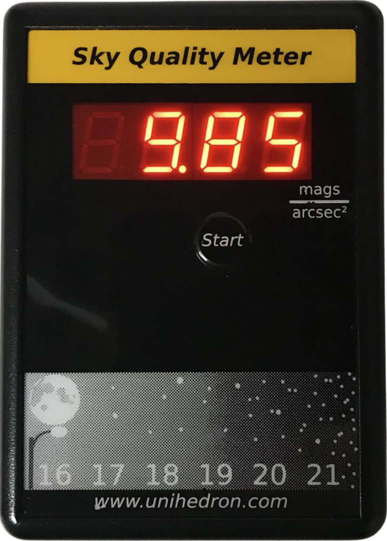
Since early 2026, I've been using a Sky Quality Meter (SQM) to measure night-sky brightness at locations around Taranaki. Higher SQM readings mean darker skies.
The interactive map below shows where I've taken measurements so far. The numbers on the map represent each location's ranking from darkest to brightest — number 1 is the darkest location recorded so far, number 2 is the second darkest, and so on. These numbers correspond directly to the ranked table beneath the map.
You can zoom in and click on each marker to explore the locations and their readings.
All SQM values are averages of three readings taken at each location. Weather, moonlight and other conditions can affect the results, so these measurements represent sky brightness at the time rather than a permanent rating.
🔴 1 — Darkest reading so far: SQM 21.69 — Pembroke Road West, approximately 560 m elevation, just outside the national park boundary.
I'll continue adding new locations as I explore and measure more of Taranaki's night skies.
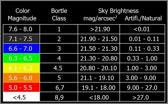
| Rank | Location (Taranaki) | SQM | Bortle | Cloud | Temp (°C) | Elevation | Date / Time |
|---|---|---|---|---|---|---|---|
| 1 | Pembroke Road West | 21.69 | 2 | 0% | 7 | 560m | 7/10/2026 · 12:00am |
| 2 | Whangamomona | 21.56 | 2 | 0% | 14 | 160m | 16/03/2026 · 12:52am |
| 3 | Strathmore Saddle | 21.45 | 3 | 0% | 14 | 246m | 15/03/2026 · 9:31pm |
| 4 | Mohakatino | 21.41 | 3 | 0% | 13 | 73m | 18/05/2026 · 7:14pm |
| 5 | Lower Timaru Rd (Lower) | 21.40 | 3 | 50% | 17 | 12m | 11/3/2026 · 11:21pm |
| 6 | Stony River (Blue Rata) | 21.31 | 4 | 0% | 15 | 326m | 20/03/2026 · 9:49pm |
| 7 | Everett Park | 21.29 | 4 | 0% | 17 | 92m | 06/02/2026 · 10:18pm (~15 min before 85% moonrise) |
| 8 | Norfolk (Bedford Rd Sth) | 21.28 | 3 | 0% | 14 | 350m | 13/09/2026 · 9:28pm |
| 9 | Tataraimaka Hall | 21.28 | 3 | 25% | 16 | 109m | 14/03/2026 · 11:19pm |
| 10 | Stent Rd | 21.27 | 3 | 50% | 16 | 50m | 14/03/2026 · 11:48pm |
| 11 | Lower Timaru Rd (Mid) | 21.25 | 3 | 25% | 16 | 62m | 14/03/2026 · 11:05pm |
| 12 | Lake Mangamahoe | 20.87 | 4 | 0% | 16 | 148m | 21/03/2026 · 10:00pm |
| 13 | Sealy Rd | 20.80 | 4 | 0% | 16 | 94m | 15/03/2026 · 12:30am |
| 14 | Port Taranaki (Sheltered) | 19.73 | 5 | 0% | 16 | 12m | 14/03/2026 · 10:40pm |
| 15 | Port Taranaki (Open) | 19.66 | 5 | 0% | 16 | 12m | 14/03/2026 · 10:45pm |
| 16 | NP Observatory (Behind) | 19.63 | 5 | 0% | 16 | 45m | 14/03/2026 · 10:08pm |
| 17 | NP Observatory (Front) | 19.54 | 5 | 0% | 16 | 45m | 14/03/2026 · 10:09pm |
| 18 | NP (Backyard) | 19.27 | 6 | 25% | 16 | 23m | 14/03/2026 & 18/02/2026 |